Image © SOM
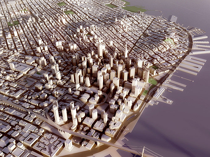
The Skidmore Owings and Merrill 3-D model, of all the things on display, is probably the most helpful with regards to planning. At the exhibit opening it was fascinating to see how engaged people became while taking a close look at all the buildings in San Francisco. The three dimensionality provides a level of understanding that is hard to replace. One can gripe about a building being too tall—seeing it in a model may provide a better perspective. This model is able to analyze the requirements of San Francisco’s planning codes as well as economic factors like the value of views, daylight, or proximity to amenities and infrastructure.